- Joined
- Jan 23, 2005
- Messages
- 355
Okay. Today is a down day chasing-wise. Sitting here in Plainview Texas sifting thru the pics I have gotten so far and thought I'd post a few. I'll add to these over the next week as I get more good stuff.
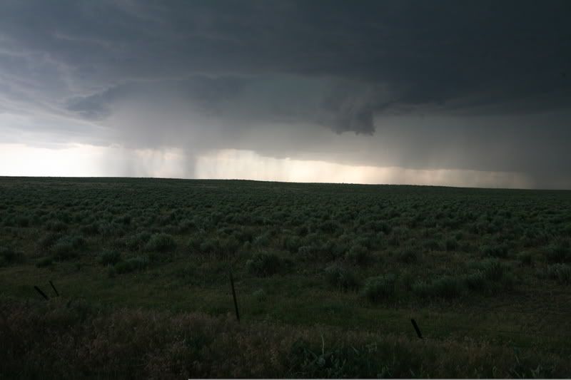
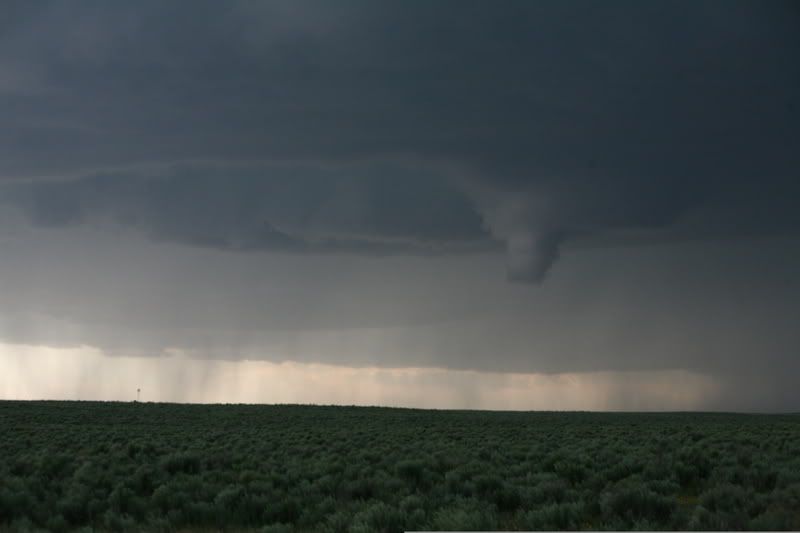
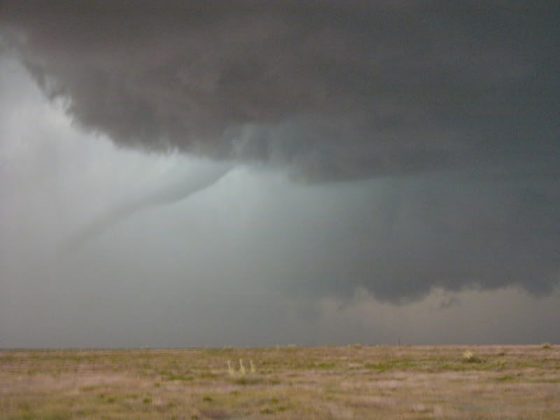
So this'll be a mix of storm photos (including 1 tornado) and other scenery from the trip
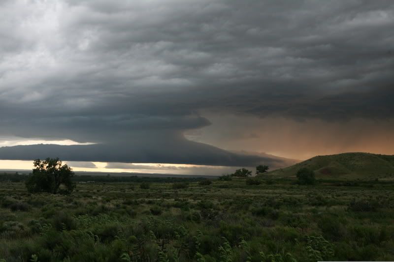
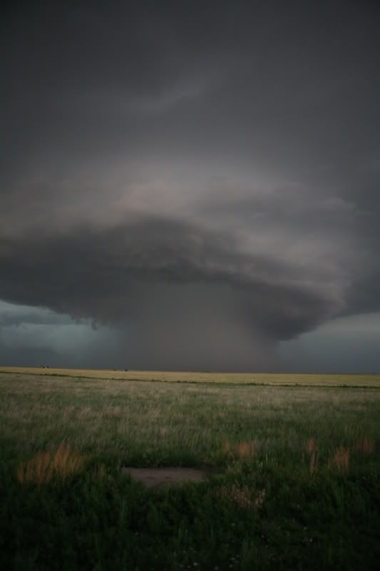
Let's start with what's called a roll cloud, which is a rolling outflow feature. This is from a storm near Fowler, Colorado on May 29
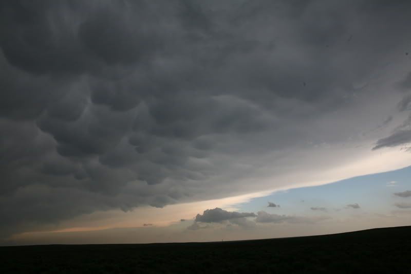
Next some mammatus. These humpy clouds that resemble udders (hence the name) form on the underside of the anvil. These were once thought to be the clouds that generated tornados. They are not, but they are cool-looking, and can be spectacular when backlit, as you'll see later
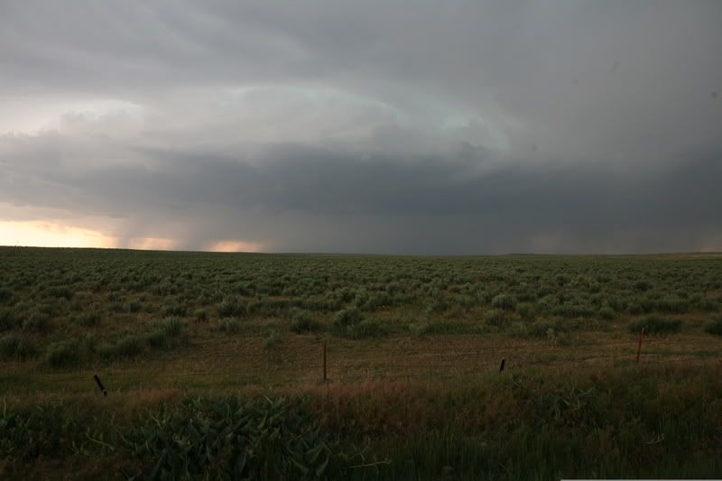
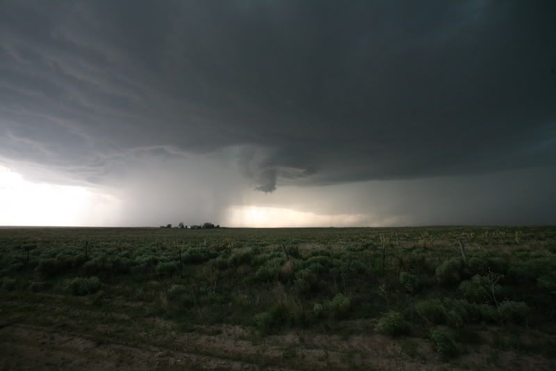
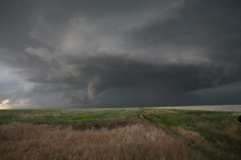
Now things get interesting, as this storm in far Eastern Colorado shows a nicely developing rotating updraft, or meso. It may not be easy to see at first, but notice the swirling pattern to the clouds, indicative of rotation
So this'll be a mix of storm photos (including 1 tornado) and other scenery from the trip
Let's start with what's called a roll cloud, which is a rolling outflow feature. This is from a storm near Fowler, Colorado on May 29
Next some mammatus. These humpy clouds that resemble udders (hence the name) form on the underside of the anvil. These were once thought to be the clouds that generated tornados. They are not, but they are cool-looking, and can be spectacular when backlit, as you'll see later
Now things get interesting, as this storm in far Eastern Colorado shows a nicely developing rotating updraft, or meso. It may not be easy to see at first, but notice the swirling pattern to the clouds, indicative of rotation
Last edited:
")